
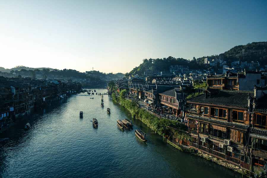
China’s great rivers run from west to east. The Yangtze, the Yellow River and the Huai all flow across the country towards the sea, and for most of Chinese history they set the shape of travel, trade and war. The Grand Canal cuts across that pattern: a man-made waterway running from north to south, from Beijing to Hangzhou, joining those east-flowing rivers into a single system. In Chinese it is called the Da Yunhe (大运河), the Great Canal. UNESCO lists its length as 1,794 kilometres, which makes it the longest artificial waterway in the world. Its oldest parts are more than 2,500 years old, and its present line was only fixed in the thirteenth century.
The canal existed because China had a problem of geography. The warm, wet south grew the rice, while the political centre lay in the drier north, where the great capitals stood. A capital needed grain every day of the year, in quantities no road system could supply: carts were slow, and the animals pulling them ate much of the load on a long journey. Water was the answer. A single barge could carry as much as dozens of carts, and a steady stream of barges could feed a capital and its armies. The Grand Canal was that river, dug by hand across the plain.
For two thousand years the canal was the artery of the empire. When it worked, grain reached the capital, taxes arrived, officials travelled to their posts, and merchants moved silk, salt, porcelain and timber between north and south. When it broke down — silted up, flooded, or cut by war — the capital went hungry and the government shook. Dynasties rose and fell around it, but the canal outlived them all, and parts of it are still at work today.
Key Facts
- Chinese name: Da Yunhe, the Great Canal
- Route: Beijing (Tongzhou) to Hangzhou, about 1,794 kilometres
- Rivers linked: the Hai, Yellow, Huai, Yangtze and Qiantang
- Oldest sections: dug from 486 BC onwards
- Joined into one system: Sui dynasty, 605–610
- Rerouted to Beijing: Yuan dynasty, 1289–1293
- Grain carried: around four million shi a year at the Ming peak
- World Heritage: added to the UNESCO World Heritage List in 2014
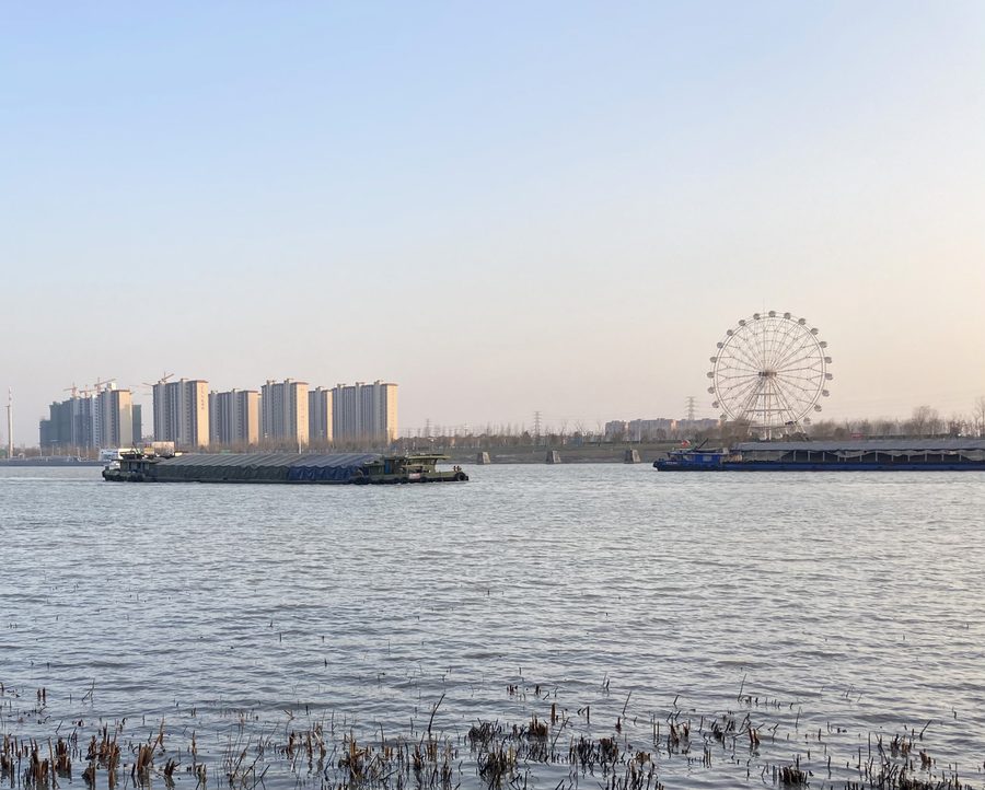
- Still in use: the southern sections carry heavy barge traffic today
The First Canals
The oldest part of the canal was dug for war. In 486 BC, King Fuchai (夫差) of Wu ordered the digging of the Hangou (邗沟) canal, a channel linking the Yangtze with the Huai River. Wu was a southern state with ambitions in the north, and the canal let its armies and grain supplies move north by water. It was a short, practical cut, but it was the first link in what would one day become the Grand Canal.
Other states followed the same idea. In the Warring States period, the state of Wei dug the Hong Gou (鸿沟), a canal that carried water from the Yellow River south towards the Huai. These early canals were separate pieces, dug by rival states for their own purposes. Nobody yet imagined a single waterway running the whole length of the country.
A more famous early canal belonged to a different story altogether. In 214 BC, Qin Shi Huang, the first emperor of the Qin dynasty, ordered the building of the Lingqu (灵渠) in the far south, a canal linking the Xiang and Li river systems so that his armies could be supplied on campaign. The Lingqu was a remarkable piece of engineering, but it is important to be clear: the Lingqu is a separate canal, hundreds of kilometres from the Grand Canal route, and it never formed part of the Grand Canal system. Its importance here is as early proof of what Chinese engineers could do: joining two river systems that nature had kept apart.
Sui: One Canal for One Empire
The canal became one system under the Sui dynasty, which reunified China in 589 after centuries of division. The Sui capital, Luoyang, sat between the productive south and the military frontier in the north, and the second Sui emperor, Emperor Yang (Yang Guang), decided to join the old canals into a single network with Luoyang at its hub. Between 605 and 610 his government dug or rebuilt three sections: the Tongji Canal (Tongji Qu, 通济渠), opened in 605, from Luoyang east to the Huai; the Yongji Canal (Yongji Qu, 永济渠), dug in 608–609, north to the region of modern Beijing; and the Jiangnan Canal, completed in 610, from Zhenjiang south to Hangzhou. Joined to the older channels, they formed a continuous waterway from the north to the Yangtze delta.
The work was done by corvée labour — ordinary farmers ordered to dig, haul earth and build embankments as part of their duty to the state. Traditional histories stress the suffering involved, and the canal works became one of the grievances that turned the population against the Sui. No reliable figures survive for the numbers involved, and the huge totals found in later accounts should not be trusted. The burden fell at the same time as the emperor’s costly campaigns against Korea and his extravagant building projects.
The Sui dynasty collapsed in 618, only eight years after the canal was completed. Historians do not blame the canal alone for the fall: it was one burden among several, alongside rebellion, military failure and the loss of support from its own officials. But the canal outlived its builder, and it was the Tang, not the Sui, that reaped the full benefit of what Emperor Yang had dug.
The Lifeline: Tang and Song
Under the Tang dynasty, the canal became the lifeline of the capital. Chang’an, the Tang capital in the north-west, could not feed itself from the dry land around it. Grain from the Yangtze delta travelled north by canal, up the Bian River (Bian He, 汴河) and through Kaifeng, then west to the capital. When the canal was blocked, prices rose in the capital within weeks. The Tang kept the waterway dredged and guarded because it had no choice.
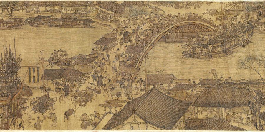
Under the Song dynasty, the centre of gravity shifted to Kaifeng itself. The Song capital stood on the Bian River, and the canal made it one of the largest and busiest cities in the world. A Northern Song court painting gives the best picture of what that meant. Along the River During the Qingming Festival, painted by Zhang Zeduan (张择端), shows the Bian River at Kaifeng crowded with boats, cargo being loaded, and crowds crossing the great Rainbow Bridge. Its Chinese title is Qingming Shanghe Tu (清明上河图). It is a work of art, not a photograph, and it shows an idealised festival day — but no other image from the period brings the canal world so vividly to life.
The system that moved the grain had a name: Caoyun (漕运), grain transport. Under Caoyun, tax grain collected in the south was loaded onto government fleets crewed by soldiers and boatmen and shipped north to the capital, running to a timetable set by the state, with granaries, checkpoints and repair yards along the route. The canal carried far more than grain: salt from the coast, silk and porcelain from the south, timber, tea and iron goods all moved along it. Officials travelled to their posts by boat, examination candidates sailed to the capital to sit their tests, and news and fashions travelled with them.
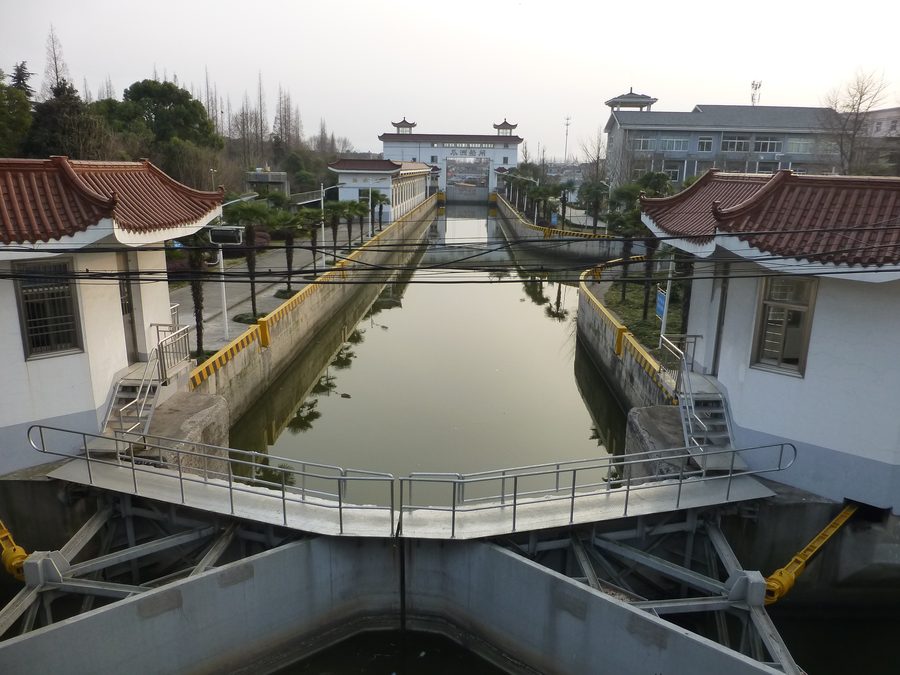
The canal also forced engineers to solve a hard problem: water does not run uphill. The land rises and falls along the route, and a boat passing from one level to another needed help. The early answer was the flash lock, a single gate that held back a rush of water. When the gate opened, boats shot through on the surge — fast, wasteful of water, and dangerous. In 977, the Song official Qiao Weiyue (乔维岳) built a better answer near Huai’an: the first pound lock. A pound lock is a chamber with a gate at each end. A boat enters, the gates close, and the water inside is filled or emptied until it matches the level on the other side. Then the far gate opens and the boat sails out, raised or lowered gently. It saved water and boats, and it let canals climb hills in a series of steps. Similar locks did not appear in Europe until centuries later.
The Yuan Shortcut
The Yuan dynasty changed the canal’s shape. When Kublai Khan, the Mongol ruler of China, made Dadu (大都) — modern Beijing — his capital, the old Sui route no longer made sense. It looped west through Luoyang and Kaifeng, adding hundreds of kilometres to the journey from the south. Kublai’s engineers cut a new, direct line across Shandong to the capital.
Two new sections fixed the route still used today. The Huitong River (Huitong He, 会通河), completed in 1289, carried the canal across the Shandong hills, climbing to the highest point of the whole waterway at Nanwang (南旺). The Tonghui River (Tonghui He, 通惠河), completed in 1293, ran from Tongzhou west into the capital, reaching Jishuitan (积水潭), a lake inside the city where grain barges could unload. The astronomer and engineer Guo Shoujing (郭守敬) took part in planning the Tonghui waterworks, designing the system that brought water from the western hills to keep the city section supplied. With these two cuts, the canal ran directly from Beijing to Hangzhou.
Read more: Genghis Khan, Founder of the World’s Largest Empire
Golden Age: Ming and Qing Canal Cities
Under the Ming dynasty and the Qing dynasty, the canal reached its busiest age. The Ming moved the capital to Beijing, and the grain fleets grew larger than ever. At their Ming peak, they carried around four million shi of grain a year to the capital — a shi was a grain measure of roughly 100 litres. Thousands of barges moved along the waterway each year, tracked by officials at every checkpoint. The canal was the largest transport system of its time, managed as a branch of the state itself.
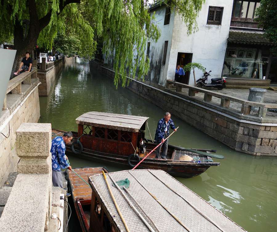
The canal made cities rich. Yangzhou, where the canal meets the Yangtze, was the seat of the salt administration for the Huai region, and the salt merchants who held the government licences became some of the richest men in China. They built gardens and mansions and turned Yangzhou into a centre of art and publishing. Suzhou, further south, grew rich on silk and trade, its own network of city canals feeding into the main waterway. Along the whole route, market towns grew up at locks, bridges and granaries, living off the traffic that passed their doors.
But the canal’s greatest enemy never went away. The Yellow River, which the canal had to cross near Huai’an at Qingkou (清口), carried enormous quantities of silt, and the crossing was the most difficult point in the whole system. Silt choked the channel, floods broke the embankments, and keeping the crossing open took a large share of the government’s water budget every year. As long as the state was strong and well organised, the battle was won. When the state weakened, the river began to win.
Read more: The Silk Road: History, Routes, Trade and Culture
Decline: River, Sea and Rail
In 1855 the Yellow River changed course. It broke its banks and shifted north to reach the sea at the Bohai Gulf, far from its old mouth. The change broke the canal’s crossing and cut off its water supply in the north. The northern sections silted up, the grain fleets could no longer get through, and the system that had fed the capital for centuries collapsed in a matter of years. The Qing government, weakened by rebellion and foreign war, could not afford the works needed to rebuild it.
At the same time, a rival appeared. Steamships could carry grain by sea from Shanghai to Tianjin faster and more cheaply than the canal, and the sea route needed no dredging. The China Merchants Steam Navigation Company, founded in 1872, ran Chinese steamships along the coast, and railways soon linked north and south by land. Against steam and rail, the slow, shallow, silt-prone canal could not compete. In the early 1900s the court ended canal grain transport in favour of sea and rail, and the northern canal fell quiet. Barges still worked the southern sections, where the water was deep and the cities were close together, but the canal’s days as the empire’s artery were over.
The Canal Today
The canal did not die. It shrank to the part of its route that still made economic sense. The southern sections, through Jiangsu and Zhejiang, remain busy waterways, carrying sand, gravel, coal, containers and grain on long trains of barges. In Suzhou, Yangzhou and Hangzhou the old waterfronts have been restored, with museums, towpaths and tour boats.
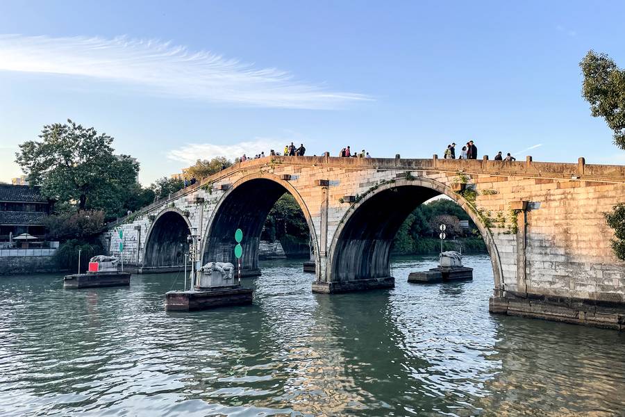
It has also found a new job. The Eastern Route of the South-North Water Transfer Project, which began carrying water north in 2013, pumps water from the Yangtze northwards along the canal route, lifting it in stages through Shandong towards Tianjin. The canal that once carried grain north now carries water north — the same problem of geography, answered with pumps instead of sails. In 2014 UNESCO added the Grand Canal to the World Heritage List. At Hangzhou, Gongchen Bridge (Gongchen Qiao, 拱宸桥) marks the southern end of the canal, where boats once began the long journey north, while Tongzhou marks the northern terminus, where the canal met the road to Beijing.
Summary
The Grand Canal was never the work of one dynasty. The state of Wu dug its first cut, the Sui joined the pieces, the Tang and Song made it a lifeline, the Yuan gave it its modern line, and the Ming and Qing ran it at its greatest scale. Each dynasty inherited the waterway, improved it, and depended on it — and each discovered that it demanded constant care. The pound lock, the dredging gangs, the towpaths and the granaries were all parts of a single machine for moving the wealth of the south to the power of the north.
That machine is still turning. Barges still move through Jiangsu and Zhejiang, and water still flows north along the old route. The emperors are gone and the grain fleets are gone, but the cut through the plain remains, 1,794 kilometres of water joining five rivers and two halves of a country — an artery that outlived the empire it served.
Read more: Chinese Dynasty Timeline